Advertisement


Chandigarh has completed the drone survey phase of the NAKSHA pilot programme, covering five villages and 15 city sectors. The next phase of field verification is set to start soon, involving 20 survey teams. The programme, part of the central government's Digital India Land Records Modernisation initiative, aims to digitize land records, reduce disputes, improve urban planning, and make property transactions more transparent and efficient. This initiative also introduces Urban Property (UrPro) cards for properties in the Lal Dora areas.
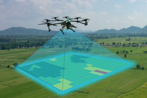
Chandigarh has successfully finished the drone survey phase under the NAKSHA pilot programme, aimed at digitizing urban land records. The survey included five villages Burail, Attawa, Kajheri, Palsora, and Sarangpur and 15 sectors of the city, ranging from Sector 2 to Sector 17. This programme is part of the central government's Digital India Land Records Modernisation Programme, which seeks to address issues such as poor record maintenance, land disputes, and delays in property transactions. Advertisement


A review meeting was held under the Deputy Commissioner Nishant Kumar Yadav, with officials from the Survey of India, National Informatics Centre, Municipal Corporation Chandigarh, Madhya Pradesh State Electronics Development Corporation, and the State Project Management Unit. Officials stressed accurate data collection and adherence to the project timeline. The Deputy Commissioner instructed proper training for surveyors and emphasized coordinated efforts among all stakeholders to ensure smooth and efficient execution.
The field verification phase is scheduled to begin shortly, with 20 survey teams, each consisting of five members. The teams will carry out verification systematically, focusing on the creation of a complete Record of Rights (RoR) for properties in Lal Dora areas of the selected villages. This process will result in the issuance of Urban Property (UrPro) cards, intended to enhance transparency and streamline property transactions in Chandigarh.
The NAKSHA programme in Chandigarh serves as a model for urban land record digitization. It combines drone-based aerial imagery, field surveys, and Geographic Information System (GIS) technology to create accurate and up-to-date digital land records. The initiative is expected to reduce disputes, support urban planning, and facilitate smoother property dealings in the city.

5th Jun, 2025

25th May, 2023

11th May, 2023

27th Apr, 2023
Advertisement


 Facebook
 Whatsapp